That is moor like it!
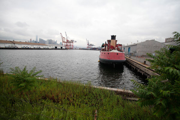
The city may chart a new course for the location of a ferry stop it is opening in Red Hook next year, after locals applied some pier pressure to put it close to homes at Atlantic Basin, instead of on the nabe’s more isolated southern coast. It isn’t a shore thing, but officials announced on Wednesday that the people’s preference is now in serious consideration.
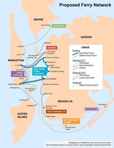
“We had to take another look at that because of the feedback we heard,” said Alex Brady of the city’s Economic Development Corporation, who came to a Community Board 6 transportation committee meeting to show off the latest proposals for the Hook stop — one of five it is opening along Brooklyn’s waterfront in 2017.
The city originally sank residents’ pitch to place the berth in the basin, near corner of Conover and Pioneer streets, because the Coast Guard periodically closes the passage for customs checks when cruise ships stop by.
But Brady said it has since found a way for ferries to get in and out of the Port Authority-controlled dock without disrupting national security, and the patrol force is now tentatively on board.
“We feel pretty good about the fact we can get in there,” he said, while adding that the site isn’t in sea-ready condition, and it would take some elbow grease to get it ship-shape
Residents — who have been pushing for their preferred site since August, creating their own maps to show how much closer the location would be to parking, homes, and businesses — were ecstatic their voices and amateur cartography had been recognized, and urged the reps to do whatever it takes to drop anchor in their dream port.
“Our primary support is for the Atlantic Basin because of the location, convenience, residential area, and central location to businesses,” said committee member Jerry Armer.
Officials are still considering several other sites, though they have rethought some of those, too.
The ferry honchos have revised their preference for a stop at the end of Van Brunt Street — one many residents said was simply too far flung — to bring the barge much closer to the shore. And they have backed away from the idea of using Valentino Pier — the only city-controlled site in the neighborhood — which they are only keeping as a last resort if all the other sites fall through.
They also floated a new idea of their own — putting the stop in Erie Basin near Ikea, where the Swedish furniture giant already runs a water taxi, though that would also be far away from the residences, Brady noted.
The city will release the draft of its study on the various options for the community to look at at the end of February, before issuing its final decision in April, reps said.
One unpopular part of the plan the city hasn’t budged on — it won’t be integrated with the MetroCard system when it launches and there will be no free transfers to buses or trains — although a ride will cost the same amount as a subway swipe.
The mayor revealed last week that the payment system may not link up with the city-run streetcar service he wants to build through the nabe, either.